Sunnycroft (St. Michael's)
Introduction
The photograph on this page of Sunnycroft (St. Michael's) by Fabian Musto as part of the Geograph project.
The Geograph project started in 2005 with the aim of publishing, organising and preserving representative images for every square kilometre of Great Britain, Ireland and the Isle of Man.

There are currently over 7.5m images from over 14,400 individuals and you can help contribute to the project by visiting https://www.geograph.org.uk
Sunnycroft (St. Michael's)
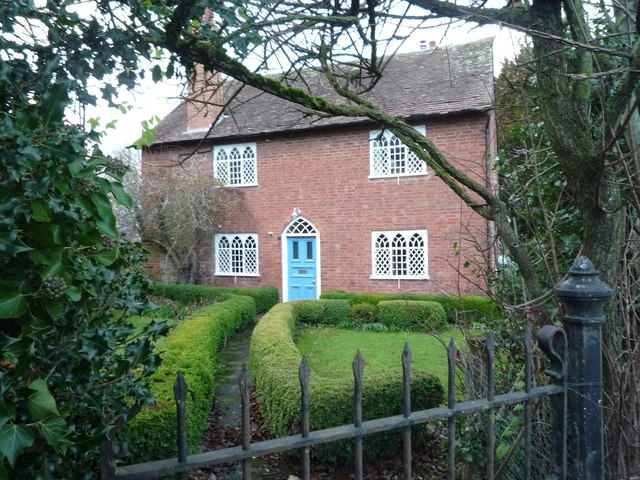
Image: © Fabian Musto Taken: 1 Dec 2018
A splendid decorated Georgian cottage by the A4112 road in St. Michael's. This is currently Grade II listed, and dates from the early 19th century.
Images are licensed for reuse under creativecommons.org/licenses/by-sa/2.0
Image Location


Leaflet Map data © OpenStreetMap
Latitude
52.289732
Longitude
-2.612785