Boundary marker, Weston Favell
Introduction
The photograph on this page of Boundary marker, Weston Favell by Stephen McKay as part of the Geograph project.
The Geograph project started in 2005 with the aim of publishing, organising and preserving representative images for every square kilometre of Great Britain, Ireland and the Isle of Man.

There are currently over 7.5m images from over 14,400 individuals and you can help contribute to the project by visiting https://www.geograph.org.uk
Boundary marker, Weston Favell
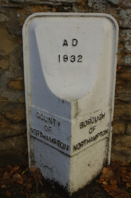
Image: © Stephen McKay Taken: 29 Nov 2018
This cast iron boundary marker dating from 1932 is located on Church Way just south of St Peter's Church. The borough has expanded considerably since then and the boundary no longer runs here.
Images are licensed for reuse under creativecommons.org/licenses/by-sa/2.0
Image Location
Latitude
52.249101
Longitude
-0.846588