The Navigation, Drake Street, Rochdale (closed)
Introduction
The photograph on this page of The Navigation, Drake Street, Rochdale (closed) by Stephen Craven as part of the Geograph project.
The Geograph project started in 2005 with the aim of publishing, organising and preserving representative images for every square kilometre of Great Britain, Ireland and the Isle of Man.

There are currently over 7.5m images from over 14,400 individuals and you can help contribute to the project by visiting https://www.geograph.org.uk
The Navigation, Drake Street, Rochdale (closed)
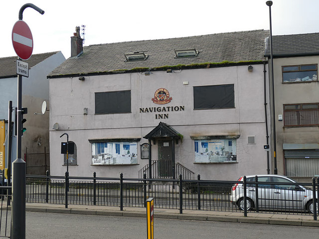
Image: © Stephen Craven Taken: 26 Nov 2018
This former Holt's pub would have taken its name from the canal basin across the road. It was still open in 2009 Image despite the absence of thirsty navvies and colliers, but has since shut.
Images are licensed for reuse under creativecommons.org/licenses/by-sa/2.0
Image Location
Latitude
53.61408
Longitude
-2.154142