The Grange
Introduction
The photograph on this page of The Grange by Ian Capper as part of the Geograph project.
The Geograph project started in 2005 with the aim of publishing, organising and preserving representative images for every square kilometre of Great Britain, Ireland and the Isle of Man.

There are currently over 7.5m images from over 14,400 individuals and you can help contribute to the project by visiting https://www.geograph.org.uk
The Grange
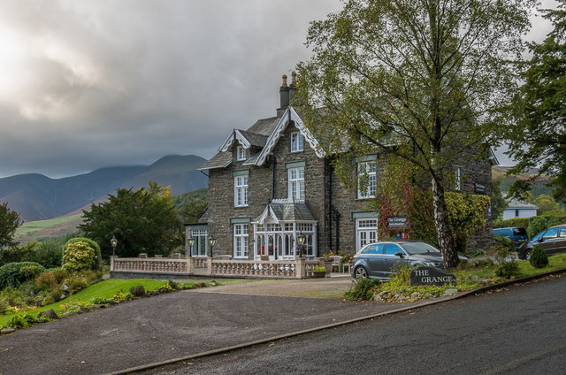
Image: © Ian Capper Taken: 24 Sep 2018
Victorian house on Manor Brow, marked on the 1864 1:2,500 map as Larch House, on the 1899 edition as The Larches and the 1968 edition as The Grange Hotel. Now marketed as The Grange Country House. In the background is Skiddaw.
Images are licensed for reuse under creativecommons.org/licenses/by-sa/2.0
Image Location
Latitude
54.598338
Longitude
-3.121015