Mountsorrel Lock in Leicestershire
Introduction
The photograph on this page of Mountsorrel Lock in Leicestershire by Roger Kidd as part of the Geograph project.
The Geograph project started in 2005 with the aim of publishing, organising and preserving representative images for every square kilometre of Great Britain, Ireland and the Isle of Man.

There are currently over 7.5m images from over 14,400 individuals and you can help contribute to the project by visiting https://www.geograph.org.uk
Mountsorrel Lock in Leicestershire
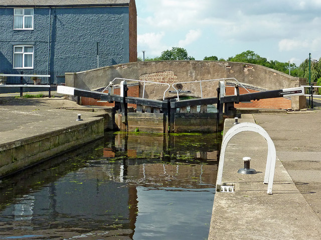
Image: © Roger Kidd Taken: 26 Aug 2013
Mountsorrel Lock is No 50 on the Grand Union Canal (Leicester Section)/Soar Navigation, and provides a rise (or fall) of 4ft 1in (1·25 metres). As with all other locks on this section, it is wide enough to accommodate two narrowboats. Bridge No 24 carries Sileby Road, yet is labelled as Mountsorrel Road Bridge.
Images are licensed for reuse under creativecommons.org/licenses/by-sa/2.0
Image Location
Latitude
52.731769
Longitude
-1.140003