
John Dower House
Introduction
The photograph on this page of John Dower House by Philip Halling as part of the Geograph project.
The Geograph project started in 2005 with the aim of publishing, organising and preserving representative images for every square kilometre of Great Britain, Ireland and the Isle of Man.

There are currently over 7.5m images from over 14,400 individuals and you can help contribute to the project by visiting https://www.geograph.org.uk
John Dower House
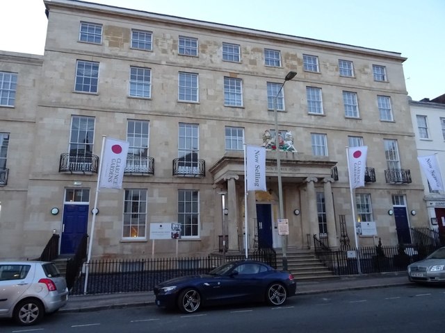
Image: © Philip Halling Taken: 6 Nov 2018
John Dower House is a Grade II Listed https://historicengland.org.uk/listing/the-list/list-entry/1104264 and has recently been converted into residential apartments and renamed John Dower House. Originally it was built as a hotel in 1828, its name being Clarence Hotel; it was later converted for use as a court and police station in the 19th Century. In 1973 the building became offices for the government department known as the Countryside Commission. Note the building still retains its royal coat of arms above the entrance porch.
Images are licensed for reuse under creativecommons.org/licenses/by-sa/2.0
Image Location

Latitude
51.900568
Longitude
-2.078146