View over Inverness City from the new Inshes Park
Introduction
The photograph on this page of View over Inverness City from the new Inshes Park by valenta as part of the Geograph project.
The Geograph project started in 2005 with the aim of publishing, organising and preserving representative images for every square kilometre of Great Britain, Ireland and the Isle of Man.

There are currently over 7.5m images from over 14,400 individuals and you can help contribute to the project by visiting https://www.geograph.org.uk
View over Inverness City from the new Inshes Park
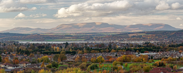
Image: © valenta Taken: 8 Nov 2018
A panoramic view shot from the new southern Inshes Park from this location Image] over Inverness. The established northern Inshes Park is just in view in the bottom of this image, with the Beauly Firth in the centre of the image. What this image demonstrates though, is how once one gains some height how Ben Wyvis over 21 miles away completely dominates the Inverness skyline to the north.
Images are licensed for reuse under creativecommons.org/licenses/by-sa/2.0
Image Location
Latitude
57.465499
Longitude
-4.195775