The Wellington Mews Arch
Introduction
The photograph on this page of The Wellington Mews Arch by Evelyn Simak as part of the Geograph project.
The Geograph project started in 2005 with the aim of publishing, organising and preserving representative images for every square kilometre of Great Britain, Ireland and the Isle of Man.

There are currently over 7.5m images from over 14,400 individuals and you can help contribute to the project by visiting https://www.geograph.org.uk
The Wellington Mews Arch
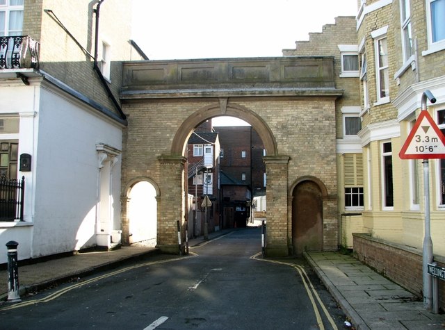
Image: © Evelyn Simak Taken: 13 Nov 2018
The Grade 2 listed archway depicted here is known as the Wellington Mews Arch. It dates from 1847 and forms the entrance to the mews behind Kimberley Terrace. It is complemented by a larger arch known as Wellington Arch, situated at the southern end of Wellington Road.
Images are licensed for reuse under creativecommons.org/licenses/by-sa/2.0
Image Location
Latitude
52.600296
Longitude
1.7348