St Mary's Church, West Malling
Introduction
The photograph on this page of St Mary's Church, West Malling by Marathon as part of the Geograph project.
The Geograph project started in 2005 with the aim of publishing, organising and preserving representative images for every square kilometre of Great Britain, Ireland and the Isle of Man.

There are currently over 7.5m images from over 14,400 individuals and you can help contribute to the project by visiting https://www.geograph.org.uk
St Mary's Church, West Malling
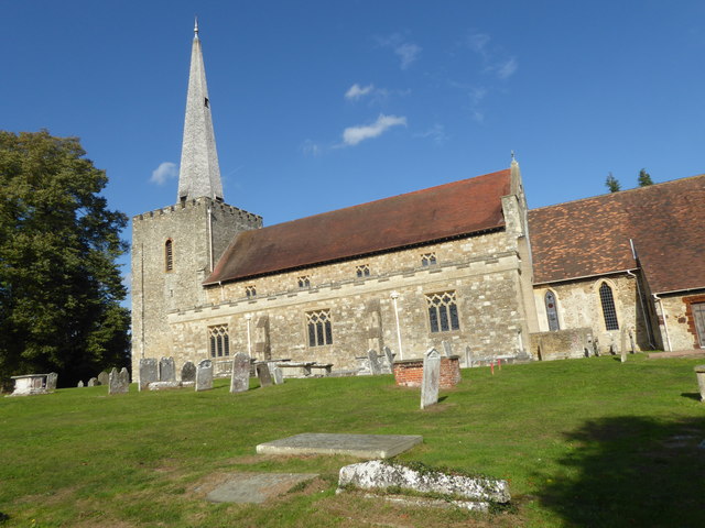
Image: © Marathon Taken: 11 Oct 2018
St Mary's Church in West Malling is at the south end of High Street, just as it turns towards Manor Park Country Park. There is early Norman evidence in the chancel and a genuine 13th century north doorway. The church was also lengthened in the 13th century. The tower also had early Norman evidence but the spire only dates from 1837. The nave was rebuilt in the 1780s and again at the start of the 20th century. See also https://www.geograph.org.uk/photo/5974006
Images are licensed for reuse under creativecommons.org/licenses/by-sa/2.0
Image Location
Latitude
51.292153
Longitude
0.406482