Dagenham: The Ship & Anchor, Becontree Heath
Introduction
The photograph on this page of Dagenham: The Ship & Anchor, Becontree Heath by Nigel Cox as part of the Geograph project.
The Geograph project started in 2005 with the aim of publishing, organising and preserving representative images for every square kilometre of Great Britain, Ireland and the Isle of Man.

There are currently over 7.5m images from over 14,400 individuals and you can help contribute to the project by visiting https://www.geograph.org.uk
Dagenham: The Ship & Anchor, Becontree Heath
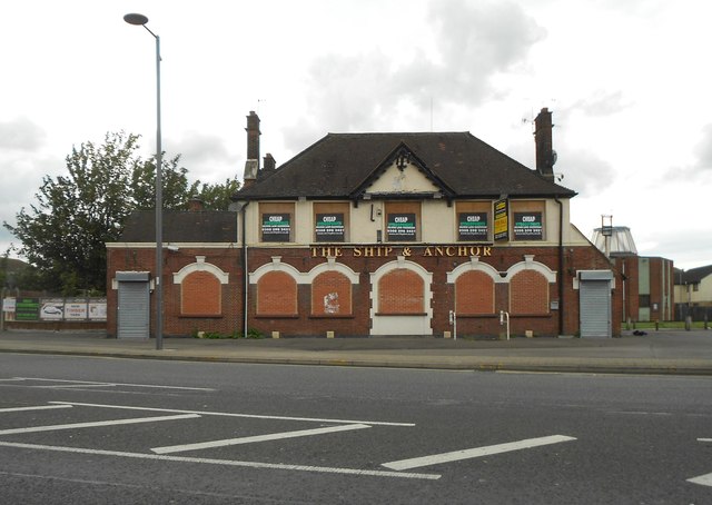
Image: © Nigel Cox Taken: 30 Jun 2016
This is The Ship & Anchor public house as most definitely closed (bricked up, not boarded up, ground floor windows for example) in June 2016. Elsewhere on the internet is a description of the pub giving the names of all the occupants as of each Census from 1851 to 1911. Unfortunately the pub is not present on any of the old large scale Ordnance Survey maps available on line, up to and including that of 1920. The building first appears as an unnamed PH on the map of 1938, and then appears as the "Hope & Anchor" PH in 1960 and 1961. Only in the 1990 edition does it show as the "Ship & Anchor". The road in front is the A124 Wood Lane.
Images are licensed for reuse under creativecommons.org/licenses/by-sa/2.0
Image Location
Latitude
51.561475
Longitude
0.148562