Stone waymarker
Introduction
The photograph on this page of Stone waymarker by John Illingworth as part of the Geograph project.
The Geograph project started in 2005 with the aim of publishing, organising and preserving representative images for every square kilometre of Great Britain, Ireland and the Isle of Man.

There are currently over 7.5m images from over 14,400 individuals and you can help contribute to the project by visiting https://www.geograph.org.uk
Stone waymarker
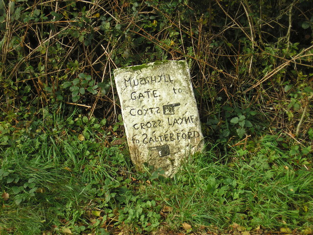
Image: © John Illingworth Taken: 17 Oct 2018
An old stone waymarker with eccentric lettering. "Coyts" is now called Coates and "Salterford" is now Salterforth. "Cross Layne" is still called Cross Lane but "Musghyll Gate" is now Salterforth Lane.
Images are licensed for reuse under creativecommons.org/licenses/by-sa/2.0
Image Location
Latitude
53.909322
Longitude
-2.164972