The M2 (northbound) at Glengormley
Introduction
The photograph on this page of The M2 (northbound) at Glengormley by Albert Bridge as part of the Geograph project.
The Geograph project started in 2005 with the aim of publishing, organising and preserving representative images for every square kilometre of Great Britain, Ireland and the Isle of Man.

There are currently over 7.5m images from over 14,400 individuals and you can help contribute to the project by visiting https://www.geograph.org.uk
The M2 (northbound) at Glengormley
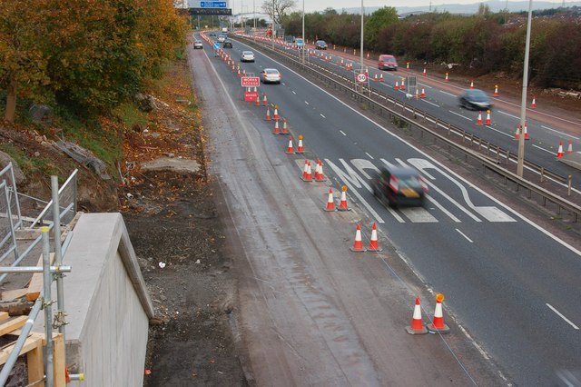
Image: © Albert Bridge Taken: 27 Oct 2007
See Image The view outwards from the Hightown Road bridge near Glengormley. The abutment for the new bridge is at lower left. The inside lane is closed to traffic but in use by contractors’ vehicles. (The Google map shows this bridge as going under rather than over the motorway).
Images are licensed for reuse under creativecommons.org/licenses/by-sa/2.0
Image Location


Leaflet Map data © OpenStreetMap
Latitude
54.669344
Longitude
-5.96501