Kerelaw Castle - Stevenston
Introduction
The photograph on this page of Kerelaw Castle - Stevenston by Raibeart MacAoidh as part of the Geograph project.
The Geograph project started in 2005 with the aim of publishing, organising and preserving representative images for every square kilometre of Great Britain, Ireland and the Isle of Man.

There are currently over 7.5m images from over 14,400 individuals and you can help contribute to the project by visiting https://www.geograph.org.uk
Kerelaw Castle - Stevenston
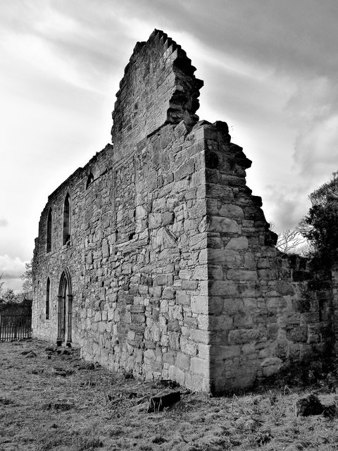
Image: © Raibeart MacAoidh Taken: 2 Nov 2018
Originally a property of the Loccard (Lockhart) family, this 15th-century castle of the Cunningham Earls of Glencairn was destroyed as the result of a feud with the Montgomerie's of Eglinton. Nearby Eglinton Castle was later burned in retaliation. The Gothic windows were added around 1830 when the ruin became a garden folly for the 18th-century mansion of Kerelaw House which stood nearby until demolished around 1970.
Images are licensed for reuse under creativecommons.org/licenses/by-sa/2.0
Image Location
Latitude
55.648325
Longitude
-4.753682