Jaywick: Sea defence wall
Introduction
The photograph on this page of Jaywick: Sea defence wall by Nigel Cox as part of the Geograph project.
The Geograph project started in 2005 with the aim of publishing, organising and preserving representative images for every square kilometre of Great Britain, Ireland and the Isle of Man.

There are currently over 7.5m images from over 14,400 individuals and you can help contribute to the project by visiting https://www.geograph.org.uk
Jaywick: Sea defence wall
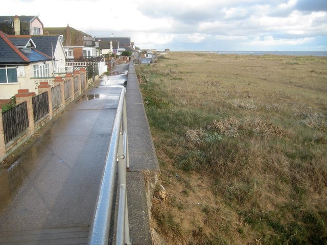
Image: © Nigel Cox Taken: 28 Oct 2018
This is the sea defence wall just to the west of Fir Way. The footway on the landward side of the wall is a public footpath. The length of seafront in Jaywick with residential properties like these extends for some 800 metres. At the time of submission of this photograph a timber framed one bedroom beach house similar to those on the left was being offered for sale for about £80,000. The brown structure on the horizon is the Martello Tower some 1.2 kilometres distant.
Images are licensed for reuse under creativecommons.org/licenses/by-sa/2.0
Image Location
Latitude
51.773354
Longitude
1.115536