Clacton-on-Sea: Clacton Airfield airstrip (1)
Introduction
The photograph on this page of Clacton-on-Sea: Clacton Airfield airstrip (1) by Nigel Cox as part of the Geograph project.
The Geograph project started in 2005 with the aim of publishing, organising and preserving representative images for every square kilometre of Great Britain, Ireland and the Isle of Man.

There are currently over 7.5m images from over 14,400 individuals and you can help contribute to the project by visiting https://www.geograph.org.uk
Clacton-on-Sea: Clacton Airfield airstrip (1)
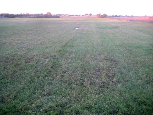
Image: © Nigel Cox Taken: 28 Oct 2018
Clacton Airfield is a single grass strip, about 600 metres long, orientated virtually due North-South. It is unusual in having a public footpath, once Alton Park Lane, crossing East-West near its middle. This view was taken looking north from that public footpath. For the view in the opposite direction please see Image] In this view the only evidence of it being an airfield is one of the white oblong concrete ground markers that define the edges of the strip. From a Geograph point of view the airstrip is erroneously shown in the grid square TM1614 on the Ordnance Survey 1:50,000 scale mapping, and not at all on the 1:25,000 scale mapping. Only at the larger scale Ordnance Survey mapping is it shown in this grid square.
Images are licensed for reuse under creativecommons.org/licenses/by-sa/2.0
Image Location
Latitude
51.785827
Longitude
1.130173