A slope near Wellington Park
Introduction
The photograph on this page of A slope near Wellington Park by Lairich Rig as part of the Geograph project.
The Geograph project started in 2005 with the aim of publishing, organising and preserving representative images for every square kilometre of Great Britain, Ireland and the Isle of Man.

There are currently over 7.5m images from over 14,400 individuals and you can help contribute to the project by visiting https://www.geograph.org.uk
A slope near Wellington Park
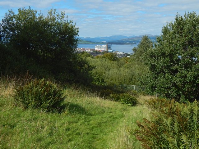
Image: © Lairich Rig Taken: 3 Sep 2018
The fence not far ahead marks what was, during the Second World War, the boundary of allotment gardens (which were on this side of the fence). See Image for a view to the photographer's left. This grassy slope is not far above three "ghost" roads, left detached after their houses were demolished. In the order in which they would be encountered when heading down this slope, they are: Image / Image / Image The large vessel in the distance is the "Royal Princess" at Greenock Ocean Terminal. Earlier on the day I had viewed it more closely from the Esplanade. The vessel is well seen in another contributor's picture of it, taken elsewhere: Image (this has a useful link to many other pictures of the ship).
Images are licensed for reuse under creativecommons.org/licenses/by-sa/2.0
Image Location
Latitude
55.936317
Longitude
-4.750072