Old milestone beside New Road
Introduction
The photograph on this page of Old milestone beside New Road by Roger Templeman as part of the Geograph project.
The Geograph project started in 2005 with the aim of publishing, organising and preserving representative images for every square kilometre of Great Britain, Ireland and the Isle of Man.

There are currently over 7.5m images from over 14,400 individuals and you can help contribute to the project by visiting https://www.geograph.org.uk
Old milestone beside New Road
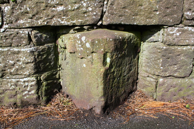
Image: © Roger Templeman Taken: 9 Apr 2018
Milestone which showed Workington 7, Whitehaven 1, and is shown as having an Ordnance Survey benchmark levelled at 193.1 feet above Liverpool Datum on the 1899 1:2500 Map. See www.bench-marks.org.uk/bm30141 for additional information. The stone is in parish of DISTINGTON (COPELAND District), Bransty, 300m S of jct of A595 by pass; opp. No. 7, in wall, on West side of road. Whitehaven plate stone Erected by the Whitehaven turnpike trust in the 19th century. Its distance plates are missing. Milestone Society National ID: CU_WHWO01
Images are licensed for reuse under creativecommons.org/licenses/by-sa/2.0
Image Location
Latitude
54.558707
Longitude
-3.578957