Loch Beag
Introduction
The photograph on this page of Loch Beag by Bill Kasman as part of the Geograph project.
The Geograph project started in 2005 with the aim of publishing, organising and preserving representative images for every square kilometre of Great Britain, Ireland and the Isle of Man.

There are currently over 7.5m images from over 14,400 individuals and you can help contribute to the project by visiting https://www.geograph.org.uk
Loch Beag
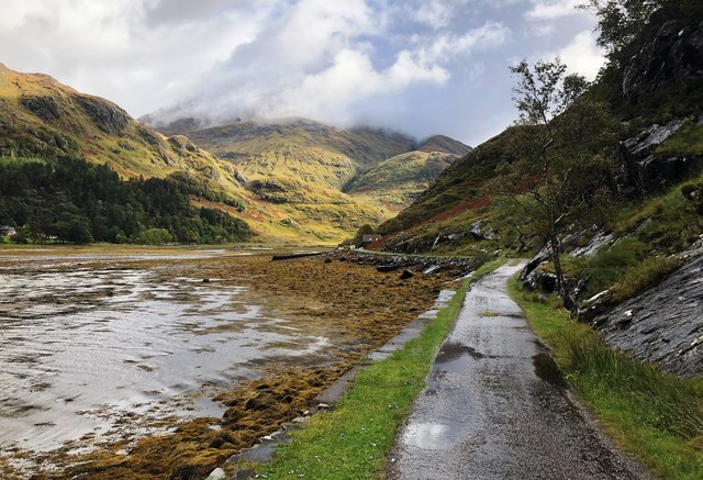
Image: © Bill Kasman Taken: 27 Sep 2018
The path from Barrisdale runs by Loch Beag on its way to Kinloch Hourn which is just around the corner. Loch Beag is the name given to the upper reaches of Loch Hourn. The mist-covered hill dead ahead is the Munro 'Sgurr a Mhaoraich' (1027m/3369ft) an excellent viewpoint for Loch Hourn - if it isn't misty! This image was taken when the tide was out and it is interesting to compare it with this image taken from pretty much the same position when the tide was in and it wasn't misty! Image
Images are licensed for reuse under creativecommons.org/licenses/by-sa/2.0
Image Location
Latitude
57.107827
Longitude
-5.387731