Egan Close/Halton Road
Introduction
The photograph on this page of Egan Close/Halton Road by Ian Capper as part of the Geograph project.
The Geograph project started in 2005 with the aim of publishing, organising and preserving representative images for every square kilometre of Great Britain, Ireland and the Isle of Man.

There are currently over 7.5m images from over 14,400 individuals and you can help contribute to the project by visiting https://www.geograph.org.uk
Egan Close/Halton Road
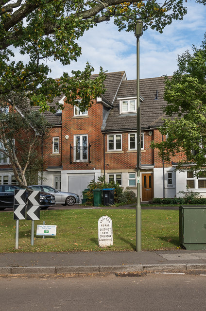
Image: © Ian Capper Taken: 12 Oct 2018
2006 development on the site of the former married quarters for personnel at RAF Kenley. In the foreground is a boundary marker for Coulsdon, dated 1895, part of what is now the London Borough of Croydon, whereas the houses themselves are in Kenley in Surrey.
Images are licensed for reuse under creativecommons.org/licenses/by-sa/2.0
Image Location
Latitude
51.299527
Longitude
-0.093977