Glanton United Reformed Church
Introduction
The photograph on this page of Glanton United Reformed Church by Gordon Hatton as part of the Geograph project.
The Geograph project started in 2005 with the aim of publishing, organising and preserving representative images for every square kilometre of Great Britain, Ireland and the Isle of Man.

There are currently over 7.5m images from over 14,400 individuals and you can help contribute to the project by visiting https://www.geograph.org.uk
Glanton United Reformed Church
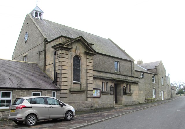
Image: © Gordon Hatton Taken: 14 Oct 2018
A curious building, particularly the vaguely classical projection on this side. The main structure dates from 1783, whilst the porch and staircase projection are of 1912.
Images are licensed for reuse under creativecommons.org/licenses/by-sa/2.0
Image Location


Leaflet Map data © OpenStreetMap
Latitude
55.424358
Longitude
-1.892378