Langleys (1)
Introduction
The photograph on this page of Langleys (1) by Chris Heaton as part of the Geograph project.
The Geograph project started in 2005 with the aim of publishing, organising and preserving representative images for every square kilometre of Great Britain, Ireland and the Isle of Man.

There are currently over 7.5m images from over 14,400 individuals and you can help contribute to the project by visiting https://www.geograph.org.uk
Langleys (1)
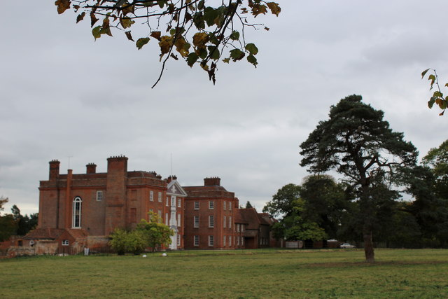
Image: © Chris Heaton Taken: 3 Oct 2018
Large red brick country house built mostly in 1719 for one Samuel Tufnell MP. Not particularly attractive to my eyes, yet granted Grade I Listed status.
Images are licensed for reuse under creativecommons.org/licenses/by-sa/2.0
Image Location
Latitude
51.7956
Longitude
0.462495