Trobridge Hill
Introduction
The photograph on this page of Trobridge Hill by Ian Capper as part of the Geograph project.
The Geograph project started in 2005 with the aim of publishing, organising and preserving representative images for every square kilometre of Great Britain, Ireland and the Isle of Man.

There are currently over 7.5m images from over 14,400 individuals and you can help contribute to the project by visiting https://www.geograph.org.uk
Trobridge Hill
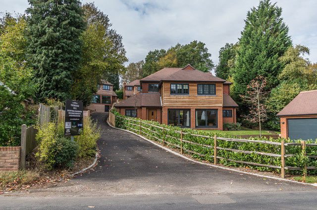
Image: © Ian Capper Taken: 12 Oct 2018
Development of 3 houses on the site of 22 Roffe's Lane, completed in 2017. The name commemorates the architect Ernest Trobridge, who was a proponent of the use of timber in construction in the 1920s and who designed the original no 22, as well its two neighbours to the north, nos 18 and 20, which both remain (see Image and Image respectively).
Images are licensed for reuse under creativecommons.org/licenses/by-sa/2.0
Image Location
Latitude
51.28107
Longitude
-0.100348