
Basingstoke Canal: Old Pondtail Bridge
Introduction
The photograph on this page of Basingstoke Canal: Old Pondtail Bridge by Nigel Cox as part of the Geograph project.
The Geograph project started in 2005 with the aim of publishing, organising and preserving representative images for every square kilometre of Great Britain, Ireland and the Isle of Man.

There are currently over 7.5m images from over 14,400 individuals and you can help contribute to the project by visiting https://www.geograph.org.uk
Basingstoke Canal: Old Pondtail Bridge
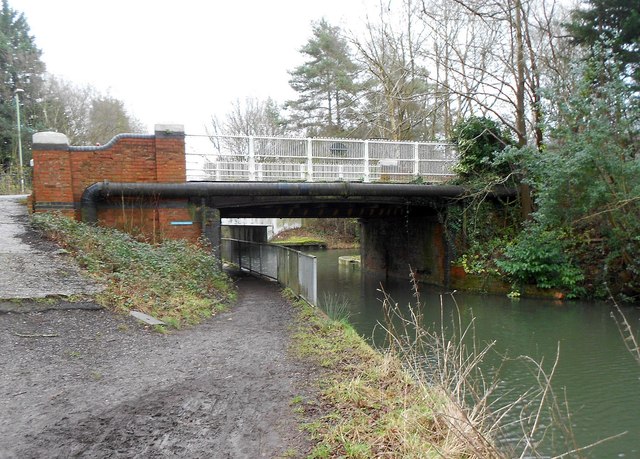
Image: © Nigel Cox Taken: 31 Jan 2016
The bridge is an 1896 replacement of the original brick arch version built when the canal was cut. It was replaced as a road bridge in the 1960s when the current one, carrying the A323 Norris Hill Road over the canal, was constructed. The newer bridge can be seen through the old bridge opening. However, as had happened at other locations on the canal, with the canal being at that time in a derelict state, no forward thinking was employed, and the new bridge was built with very limited headroom for future canal craft. It can be seen that the underside of the new concrete bridge is much lower than that of the 1896 one.
Images are licensed for reuse under creativecommons.org/licenses/by-sa/2.0
Image Location

Latitude
51.276511
Longitude
-0.821358