Gardenstown
Introduction
The photograph on this page of Gardenstown by Anne Burgess as part of the Geograph project.
The Geograph project started in 2005 with the aim of publishing, organising and preserving representative images for every square kilometre of Great Britain, Ireland and the Isle of Man.

There are currently over 7.5m images from over 14,400 individuals and you can help contribute to the project by visiting https://www.geograph.org.uk
Gardenstown
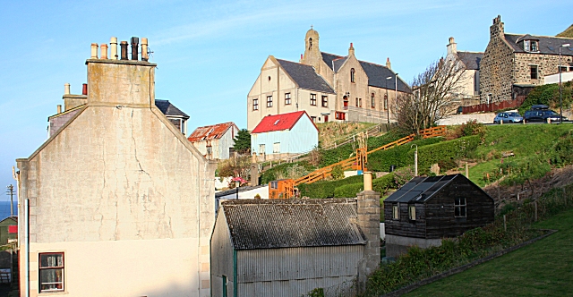
Image: © Anne Burgess Taken: 24 Oct 2007
The road out of Gardenstown winds steeply up the hill in a series of hairpin bends, one of which is dominated by the Church of Scotland kirk, seen here on the skyline.
Images are licensed for reuse under creativecommons.org/licenses/by-sa/2.0
Image Location


Leaflet Map data © OpenStreetMap
Latitude
57.672715
Longitude
-2.33528