The Court House
Introduction
The photograph on this page of The Court House by Michael Dibb as part of the Geograph project.
The Geograph project started in 2005 with the aim of publishing, organising and preserving representative images for every square kilometre of Great Britain, Ireland and the Isle of Man.

There are currently over 7.5m images from over 14,400 individuals and you can help contribute to the project by visiting https://www.geograph.org.uk
The Court House
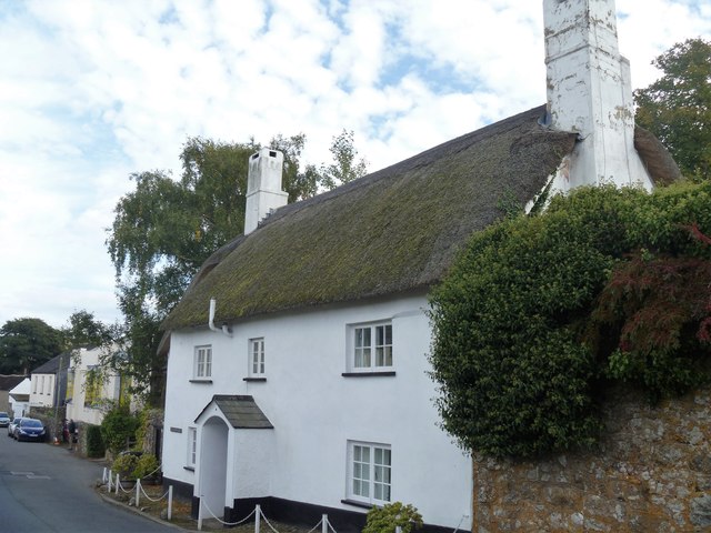
Image: © Michael Dibb Taken: 24 Sep 2018
This fine early 17th century two roomed house has a late 17th century wing at right angles. The house has many original features and the Court Leet was held her until circa 1847. Listed, grade II, with details at: https://historicengland.org.uk/listing/the-list/list-entry/1146984
Images are licensed for reuse under creativecommons.org/licenses/by-sa/2.0
Image Location
Latitude
50.659939
Longitude
-3.770575