Denton Island
Introduction
The photograph on this page of Denton Island by Simon Carey as part of the Geograph project.
The Geograph project started in 2005 with the aim of publishing, organising and preserving representative images for every square kilometre of Great Britain, Ireland and the Isle of Man.

There are currently over 7.5m images from over 14,400 individuals and you can help contribute to the project by visiting https://www.geograph.org.uk
Denton Island
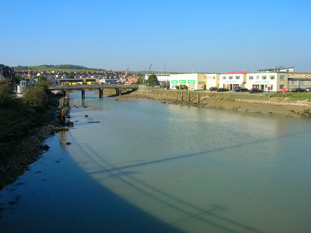
Image: © Simon Carey Taken: 23 Oct 2007
Formed when the North Quay was cut in the mid 19th century. The meandering loop around the island is the old course of the River Ouse and the bridge onto the newly formed island is near the site of the original wooden bridge which took the route to Seaford following the northern side of the river bank. The island was initially another marine and industrial area but has now been redeveloped and includes showrooms, business centres, a college campus and an indoor bowls club.
Images are licensed for reuse under creativecommons.org/licenses/by-sa/2.0
Image Location


Leaflet Map data © OpenStreetMap
Latitude
50.795486
Longitude
0.050234