Orkney Place
Introduction
The photograph on this page of Orkney Place by Thomas Nugent as part of the Geograph project.
The Geograph project started in 2005 with the aim of publishing, organising and preserving representative images for every square kilometre of Great Britain, Ireland and the Isle of Man.

There are currently over 7.5m images from over 14,400 individuals and you can help contribute to the project by visiting https://www.geograph.org.uk
Orkney Place
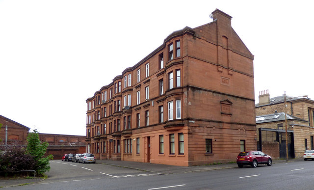
Image: © Thomas Nugent Taken: 27 Aug 2018
Formerly named Russell Street. The black gate led to the yard of the former Govan fire station https://www.theglasgowstory.com/image/?inum=TGSE00752 which was located in the nearest corner of the ground floor of the tenement. The difference in colour of the building fabric and different window configuration from the rest of the ground floor reveals the location of the old fire station, which closed in 1987, having been replaced with a new one nearby Image
Images are licensed for reuse under creativecommons.org/licenses/by-sa/2.0
Image Location
Latitude
55.86081
Longitude
-4.308747