Hulme Lock, Bridgewater Canal, Manchester.
Introduction
The photograph on this page of Hulme Lock, Bridgewater Canal, Manchester. by Dr Neil Clifton as part of the Geograph project.
The Geograph project started in 2005 with the aim of publishing, organising and preserving representative images for every square kilometre of Great Britain, Ireland and the Isle of Man.

There are currently over 7.5m images from over 14,400 individuals and you can help contribute to the project by visiting https://www.geograph.org.uk
Hulme Lock, Bridgewater Canal, Manchester.
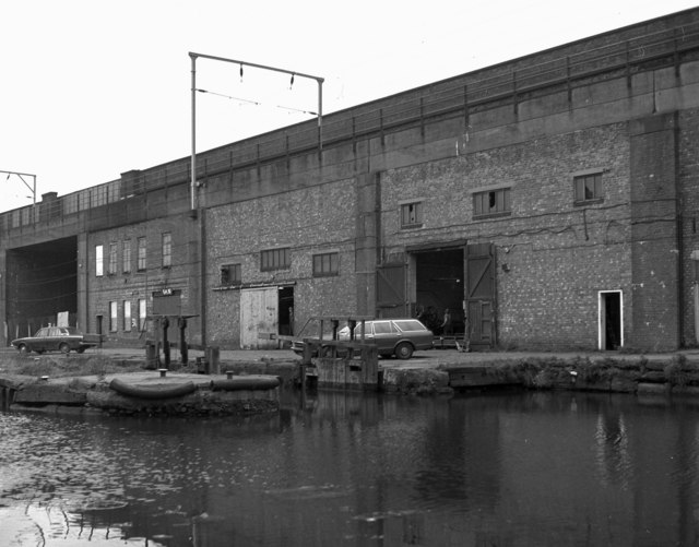
Image: © Dr Neil Clifton Taken: 12 Apr 1981
On the north side of the canal is seen Hulme Lock, the top one of three that led down from the Bridgewater Canal to the Manchester Ship Canal. Very little use was made of it latterly, as pleasure boats are not normally allowed onto the Ship Canal, and barge traffic had ceased by 1981 when this was taken. These locks are now closed and have been replaced by an alternative arrangement. Above the water is seen the railway which later became part of Manchester's tram system.
Images are licensed for reuse under creativecommons.org/licenses/by-sa/2.0
Image Location


Leaflet Map data © OpenStreetMap
Latitude
53.474576
Longitude
-2.260153