Former Abbey Mill in Leicester
Introduction
The photograph on this page of Former Abbey Mill in Leicester by Roger Kidd as part of the Geograph project.
The Geograph project started in 2005 with the aim of publishing, organising and preserving representative images for every square kilometre of Great Britain, Ireland and the Isle of Man.

There are currently over 7.5m images from over 14,400 individuals and you can help contribute to the project by visiting https://www.geograph.org.uk
Former Abbey Mill in Leicester
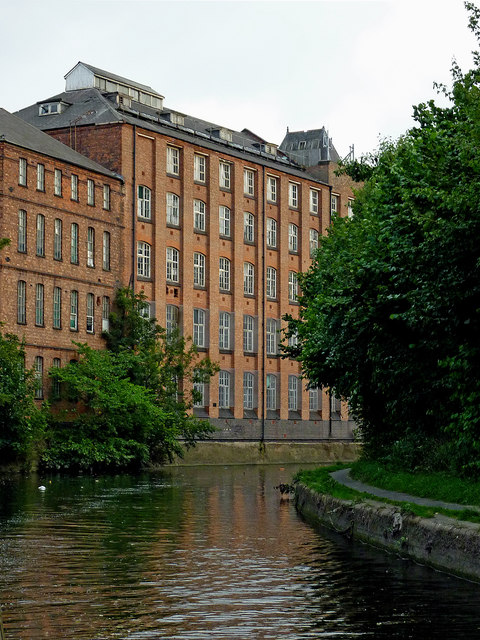
Image: © Roger Kidd Taken: 25 Aug 2013
Ahead are the former Abbey Mill buildings (dating from 1884) which are being converted to living accommodation for the elderly and vulnerable. This is by the Grand Union Canal/Soar Navigation below Lime Kiln Lock and Bridge No 9. This section is level with the nearby River Soar (off to the right past Frog Island) so is prone to slight flooding when the river is high.
Images are licensed for reuse under creativecommons.org/licenses/by-sa/2.0
Image Location
Latitude
52.646547
Longitude
-1.128078