Grand Union Canal near Black Friars in Leicester
Introduction
The photograph on this page of Grand Union Canal near Black Friars in Leicester by Roger Kidd as part of the Geograph project.
The Geograph project started in 2005 with the aim of publishing, organising and preserving representative images for every square kilometre of Great Britain, Ireland and the Isle of Man.

There are currently over 7.5m images from over 14,400 individuals and you can help contribute to the project by visiting https://www.geograph.org.uk
Grand Union Canal near Black Friars in Leicester
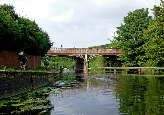
Image: © Roger Kidd Taken: 25 Aug 2013
This image shows Soar Lane Bridge, No 4 across the Soar Navigation/Grand Union Canal near Black Friars in Leicester. Boats are made to use the western of the two arches. Jo Turner informs us that: Around the time of the construction of the Soar Navigation in 1790, a wooden bridge was constructed over the Soar to give access to the towpath from the end of Soar Lane. This accommodation bridge was just for pedestrians and horses. The Midland Railway built three bridges in the 1880’s when a Flood Scheme was implemented, realigning the river channels. Soar Lane now crossed both the navigation and the much deeper Soar. A railway lifting bridge had been in that position on the navigation since the 1830’s and its permanent height above the water of the navigation on the east side meant that no boats could pass under it and pilings and rails were installed to direct the boat traffic through the correct channel. Soar Lane road bridge from its construction has never been able to allow traffic through its east arch even after the railway bridge was removed. This is due to the foundations to the lifting platform’s frame being too extensive to allow economic removal.
Images are licensed for reuse under creativecommons.org/licenses/by-sa/2.0
Image Location
Latitude
52.638394
Longitude
-1.1442