The River Soar/Grand Union Canal in Leicester
Introduction
The photograph on this page of The River Soar/Grand Union Canal in Leicester by Roger Kidd as part of the Geograph project.
The Geograph project started in 2005 with the aim of publishing, organising and preserving representative images for every square kilometre of Great Britain, Ireland and the Isle of Man.

There are currently over 7.5m images from over 14,400 individuals and you can help contribute to the project by visiting https://www.geograph.org.uk
The River Soar/Grand Union Canal in Leicester
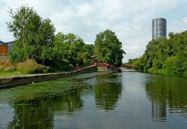
Image: © Roger Kidd Taken: 25 Aug 2013
Ahead is the River Soar/Grand Union Canal, while the Old River Soar continues to the left under the towpath bridge, rejoining the main channel about 1500 metres ahead. The tower block is The Summit, one of Leicester's new landmarks, a 67 metre tall development of student flats. N. Chadwick and Jo Turner add:
Images are licensed for reuse under creativecommons.org/licenses/by-sa/2.0
Image Location
Latitude
52.624813
Longitude
-1.143283