East Leake: pinfold and Glebe Farmhouse
Introduction
The photograph on this page of East Leake: pinfold and Glebe Farmhouse by John Sutton as part of the Geograph project.
The Geograph project started in 2005 with the aim of publishing, organising and preserving representative images for every square kilometre of Great Britain, Ireland and the Isle of Man.

There are currently over 7.5m images from over 14,400 individuals and you can help contribute to the project by visiting https://www.geograph.org.uk
East Leake: pinfold and Glebe Farmhouse
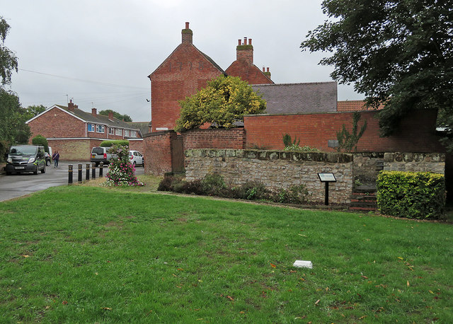
Image: © John Sutton Taken: 11 Sep 2018
The Grade II listed pinfold is 18th century and built of coursed rubble. Behind it are the two gables of Glebe Farmhouse, dated 1797 (right gable) and 1798 in darker brick. The farmhouse is also Grade II listed.
Images are licensed for reuse under creativecommons.org/licenses/by-sa/2.0
Image Location
Latitude
52.831035
Longitude
-1.180792