The Valasay/Bhalasaigh footbridge
Introduction
The photograph on this page of The Valasay/Bhalasaigh footbridge by Oliver Dixon as part of the Geograph project.
The Geograph project started in 2005 with the aim of publishing, organising and preserving representative images for every square kilometre of Great Britain, Ireland and the Isle of Man.

There are currently over 7.5m images from over 14,400 individuals and you can help contribute to the project by visiting https://www.geograph.org.uk
The Valasay/Bhalasaigh footbridge
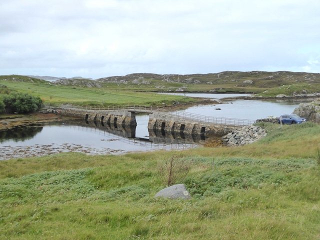
Image: © Oliver Dixon Taken: 3 Sep 2018
Footbridge over the narrows at the mouth of the Tób Bhalasaigh, a very long enclosed arm of the sea. The bridge was built in 1898 to connect the houses on the west bank with the rest of Great Bernera.
Images are licensed for reuse under creativecommons.org/licenses/by-sa/2.0
Image Location
Latitude
58.225338
Longitude
-6.861189