Star & Garter House
Introduction
The photograph on this page of Star & Garter House by Keith Edkins as part of the Geograph project.
The Geograph project started in 2005 with the aim of publishing, organising and preserving representative images for every square kilometre of Great Britain, Ireland and the Isle of Man.

There are currently over 7.5m images from over 14,400 individuals and you can help contribute to the project by visiting https://www.geograph.org.uk
Star & Garter House
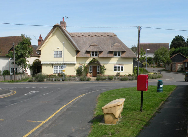
Image: © Keith Edkins Taken: 3 Sep 2018
Former inn, late C18 or early C19. Painted brick street facade with timber framed and plastered gable walls. Roof has been restored to thatch (described as red pantile in 1984 listing record). Grade II listed. The postbox in the foreground is CB8 65.
Images are licensed for reuse under creativecommons.org/licenses/by-sa/2.0
Image Location
Latitude
52.22266
Longitude
0.462633