Saltby from the Sproxton road
Introduction
The photograph on this page of Saltby from the Sproxton road by Kate Jewell as part of the Geograph project.
The Geograph project started in 2005 with the aim of publishing, organising and preserving representative images for every square kilometre of Great Britain, Ireland and the Isle of Man.

There are currently over 7.5m images from over 14,400 individuals and you can help contribute to the project by visiting https://www.geograph.org.uk
Saltby from the Sproxton road
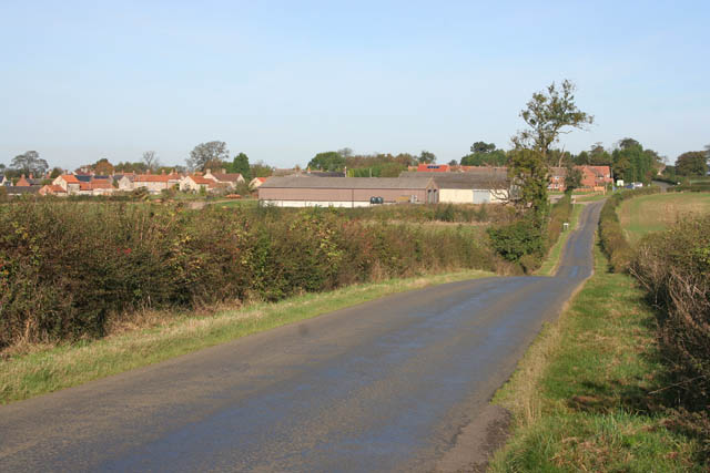
Image: © Kate Jewell Taken: 18 Oct 2007
The Church is hidden behind the trees on the far right horizon. Hawthorn Farm is in the centre and Back Lane crosses from right to left in front of the red brick houses. The village centre is on the far left on the boundary with Image
Images are licensed for reuse under creativecommons.org/licenses/by-sa/2.0
Image Location
Latitude
52.826698
Longitude
-0.737404