Greenfield Hush
Introduction
The photograph on this page of Greenfield Hush by Gordon Hatton as part of the Geograph project.
The Geograph project started in 2005 with the aim of publishing, organising and preserving representative images for every square kilometre of Great Britain, Ireland and the Isle of Man.

There are currently over 7.5m images from over 14,400 individuals and you can help contribute to the project by visiting https://www.geograph.org.uk
Greenfield Hush
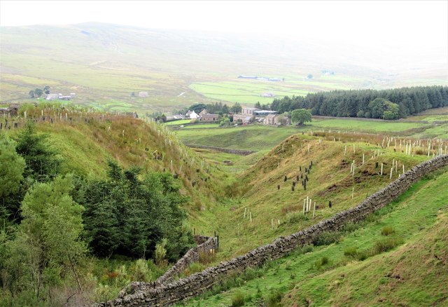
Image: © Gordon Hatton Taken: 14 Aug 2018
Stopping at the roadside and looking at this steep sided little valley, I couldn't be sure if it was natural or man-made. The old OS 6" maps provide the answer as this is named as Greenfield Hush, so is definitely the work of lead miners, who if alive today would probably be astonished at how it has blended back into the landscape.
Images are licensed for reuse under creativecommons.org/licenses/by-sa/2.0
Image Location
Latitude
54.772239
Longitude
-2.236553