'Farmer's Boy'
Introduction
The photograph on this page of 'Farmer's Boy' by Jonathan Hutchins as part of the Geograph project.
The Geograph project started in 2005 with the aim of publishing, organising and preserving representative images for every square kilometre of Great Britain, Ireland and the Isle of Man.

There are currently over 7.5m images from over 14,400 individuals and you can help contribute to the project by visiting https://www.geograph.org.uk
'Farmer's Boy'
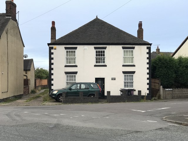
Image: © Jonathan Hutchins Taken: 22 Jul 2018
An unusual name for a private dwelling: this is because it was formerly a pub of the same name. The drive down the left-hand side of the house, as viewed here from the road, is the route of a public footpath, Audley 75.
Images are licensed for reuse under creativecommons.org/licenses/by-sa/2.0
Image Location
Latitude
53.031086
Longitude
-2.291471