Nos 10 & 12 Logies Lane, St Andrews
Introduction
The photograph on this page of Nos 10 & 12 Logies Lane, St Andrews by Richard Law as part of the Geograph project.
The Geograph project started in 2005 with the aim of publishing, organising and preserving representative images for every square kilometre of Great Britain, Ireland and the Isle of Man.

There are currently over 7.5m images from over 14,400 individuals and you can help contribute to the project by visiting https://www.geograph.org.uk
Nos 10 & 12 Logies Lane, St Andrews
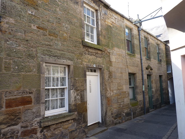
Image: © Richard Law Taken: 17 May 2018
Dating from the early and mid 19th century respectively, nos 10 & 12 were Category C listed https://britishlistedbuildings.co.uk/200386933-8-9-10-11-logies-lane-st-andrews-ward#.W35UJ-hKhPZ in 1971. The houses on the rest of the terrace to their left are similarly listed.
Images are licensed for reuse under creativecommons.org/licenses/by-sa/2.0
Image Location
Latitude
56.340186
Longitude
-2.796485