Access to Red House beyond red gate
Introduction
The photograph on this page of Access to Red House beyond red gate by Trevor Littlewood as part of the Geograph project.
The Geograph project started in 2005 with the aim of publishing, organising and preserving representative images for every square kilometre of Great Britain, Ireland and the Isle of Man.

There are currently over 7.5m images from over 14,400 individuals and you can help contribute to the project by visiting https://www.geograph.org.uk
Access to Red House beyond red gate
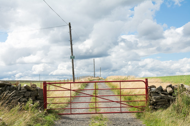
Image: © Trevor Littlewood Taken: 8 Aug 2018
OS maps show the road as an "Other Route with Public Access". It seems that the occupiers of the farm don't necessarily see it that way... there's a notice fixed to a pole, set high and out of reach, that tells "Private Road No Entry". Now there probably is no public motor access along the way but there's a padlock on the gate which would prevent that anyway. The lock also means that the gate has to be climbed by pedestrians!
Images are licensed for reuse under creativecommons.org/licenses/by-sa/2.0
Image Location
Latitude
54.803608
Longitude
-1.894808