The Bentley Canal footbridge
Introduction
The photograph on this page of The Bentley Canal footbridge by Richard Law as part of the Geograph project.
The Geograph project started in 2005 with the aim of publishing, organising and preserving representative images for every square kilometre of Great Britain, Ireland and the Isle of Man.

There are currently over 7.5m images from over 14,400 individuals and you can help contribute to the project by visiting https://www.geograph.org.uk
The Bentley Canal footbridge
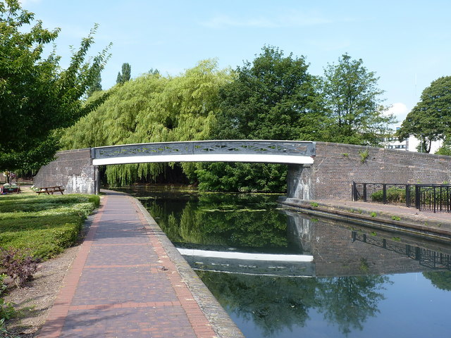
Image: © Richard Law Taken: 19 Jul 2018
A towpath bridge over the remaining very short stretch of what was originally the Bentley Canal branch, which led from the Wyrley and Essington cut through Willenhall towards Bentley Bridge, where it joined the Walsall Canal at Anson, as seen in Image The bridge itself will date from around 1843, the date at which the main line was opened, and was Grade II listed https://britishlistedbuildings.co.uk/101201908-footbridge-over-west-end-of-bentley-canal-wednesfield-south-ward#.W3Uao-hKhPY in 1992.
Images are licensed for reuse under creativecommons.org/licenses/by-sa/2.0
Image Location
Latitude
52.596947
Longitude
-2.092523