Building site, The Fairway
Introduction
The photograph on this page of Building site, The Fairway by John Baker as part of the Geograph project.
The Geograph project started in 2005 with the aim of publishing, organising and preserving representative images for every square kilometre of Great Britain, Ireland and the Isle of Man.

There are currently over 7.5m images from over 14,400 individuals and you can help contribute to the project by visiting https://www.geograph.org.uk
Building site, The Fairway
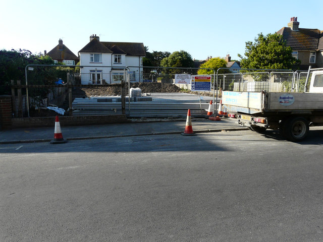
Image: © John Baker Taken: 13 Jul 2018
Viewed from South Road, planning permission has been approved, with conditions, by Folkestone and Hythe District Council under application number Y16/0587/SH for the “erection of a block of three flats (2 x two bedroom apartments and 1 x three bedroom[s]) together with associated parking and amenity space”. The flats are to be erected in the former garden of Moyle Cottage, which is the house beyond the site. The Fairway is a cul-de-sac, which runs along the right side of the site. Now that construction has been completed, the flats are located in a building called Image
Images are licensed for reuse under creativecommons.org/licenses/by-sa/2.0
Image Location
Latitude
51.066644
Longitude
1.085373