
Western end of the Water of Leith Walkway
Introduction
The photograph on this page of Western end of the Water of Leith Walkway by Jim Barton as part of the Geograph project.
The Geograph project started in 2005 with the aim of publishing, organising and preserving representative images for every square kilometre of Great Britain, Ireland and the Isle of Man.

There are currently over 7.5m images from over 14,400 individuals and you can help contribute to the project by visiting https://www.geograph.org.uk
Western end of the Water of Leith Walkway
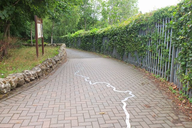
Image: © Jim Barton Taken: 3 Aug 2018
The Water of Leith rises on the north side of West Cairn in the Pentland Hills, flowing through Edinburgh to enter the Firth of Forth at Leith. The walkway is a 12.75 mile (20km) route following an old railway line to Slateford, then paths and pavements to Leith. The start here is just past Balerno High School and the course of the Water of Leith has been inset as a metal strip into the blockwork surface of the path.
Images are licensed for reuse under creativecommons.org/licenses/by-sa/2.0
Image Location

Latitude
55.88759
Longitude
-3.338617