Barley: War Memorial and Lock-up
Introduction
The photograph on this page of Barley: War Memorial and Lock-up by John Sutton as part of the Geograph project.
The Geograph project started in 2005 with the aim of publishing, organising and preserving representative images for every square kilometre of Great Britain, Ireland and the Isle of Man.

There are currently over 7.5m images from over 14,400 individuals and you can help contribute to the project by visiting https://www.geograph.org.uk
Barley: War Memorial and Lock-up
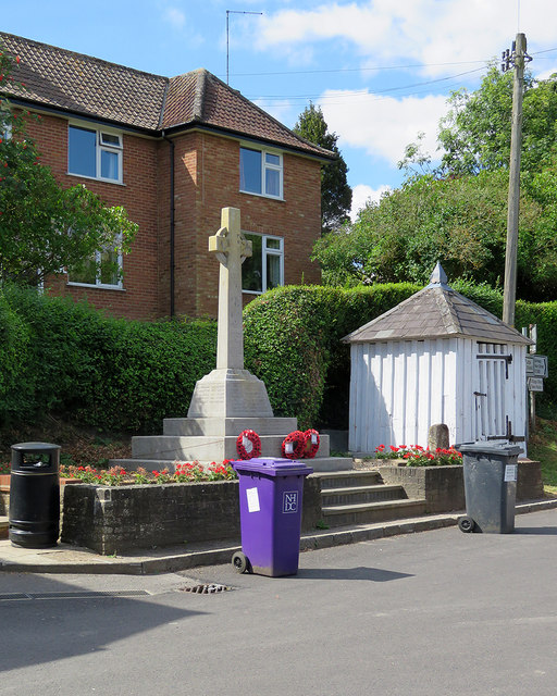
Image: © John Sutton Taken: 1 Aug 2018
The Grade II listing text for the Cage or Lock-up begins "Former village lock-up. C17, restored c 1970. Timber frame. Pyramidal slate roof. Approximately cubic. Close-studded plank and muntin frame with 8 studs to each side". The War Memorial of 1919 is also Grade II listed.
Images are licensed for reuse under creativecommons.org/licenses/by-sa/2.0
Image Location
Latitude
52.026012
Longitude
0.038109