Porth-y-Cwrogl
Introduction
The photograph on this page of Porth-y-Cwrogl by Eirian Evans as part of the Geograph project.
The Geograph project started in 2005 with the aim of publishing, organising and preserving representative images for every square kilometre of Great Britain, Ireland and the Isle of Man.

There are currently over 7.5m images from over 14,400 individuals and you can help contribute to the project by visiting https://www.geograph.org.uk
Porth-y-Cwrogl
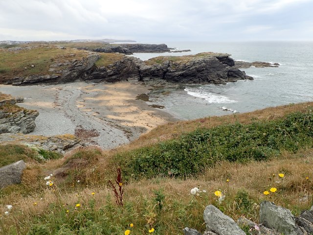
Image: © Eirian Evans Taken: 27 Jul 2018
Porth-y-Cwrogl is a small sheltered cove on the west coast of Holy Island. It is mostly of sand and shingle, and backed by a sea wall. It is approximately 50 yards wide and flanked by rocks and low cliffs of mica-schist which show unusual swirly patterns. The sea water is often crystal clear in summer, making it ideal for swimming, snorkelling and scuba diving.
Images are licensed for reuse under creativecommons.org/licenses/by-sa/2.0
Image Location
Latitude
53.284799
Longitude
-4.641148