
Chain at Point of Scattland
Introduction
The photograph on this page of Chain at Point of Scattland by Andy Waddington as part of the Geograph project.
The Geograph project started in 2005 with the aim of publishing, organising and preserving representative images for every square kilometre of Great Britain, Ireland and the Isle of Man.

There are currently over 7.5m images from over 14,400 individuals and you can help contribute to the project by visiting https://www.geograph.org.uk
Chain at Point of Scattland
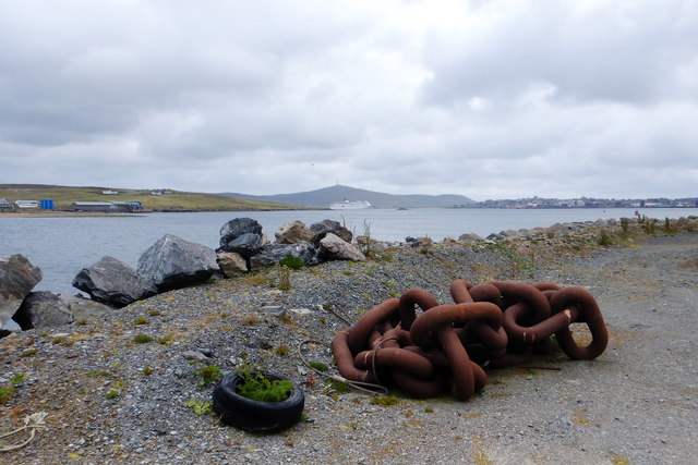
Image: © Andy Waddington Taken: 22 Jun 2018
Point of Scattland seems to have got bigger since the publication of the map I was using, and now sticks out further into Bressay Sound opposite Heogan. There seems nothing to discourage the geographer from venturing here to get definitively inside this grid square. Just behind the photographer's feet is a large bollard bolted into a concrete pad, to which the chain could possibly be attached (although it looks a tight fit). It doesn't really look long enough to reach as far as a ship alongside. Bressay Sound extends SSW to pass between Lerwick and the island of Bressay. It's a narrow channel, busy with traffic, so it seems bizarre that cruise ships (often much bigger than the one seen here) can anchor in the middle leaving barely enough space for the regular ferries to Orkney and mainland Scotland to pass.
Images are licensed for reuse under creativecommons.org/licenses/by-sa/2.0
Image Location

Latitude
60.175029
Longitude
-1.153625