Cliffs and hinterland south of Bird's Rock
Introduction
The photograph on this page of Cliffs and hinterland south of Bird's Rock by Zorba the Geek as part of the Geograph project.
The Geograph project started in 2005 with the aim of publishing, organising and preserving representative images for every square kilometre of Great Britain, Ireland and the Isle of Man.

There are currently over 7.5m images from over 14,400 individuals and you can help contribute to the project by visiting https://www.geograph.org.uk
Cliffs and hinterland south of Bird's Rock
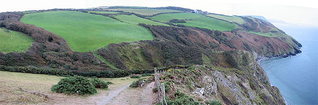
Image: © Zorba the Geek Taken: 1 Oct 2007
A little south of Image, this wide view from the coastal path shows both precipitous cliffs and clifftop pastures. The farm on the further hilltop is Coybal.
Images are licensed for reuse under creativecommons.org/licenses/by-sa/2.0
Image Location
Latitude
52.211099
Longitude
-4.381392