Moat farm and outbuildings
Introduction
The photograph on this page of Moat farm and outbuildings by Bob Harvey as part of the Geograph project.
The Geograph project started in 2005 with the aim of publishing, organising and preserving representative images for every square kilometre of Great Britain, Ireland and the Isle of Man.

There are currently over 7.5m images from over 14,400 individuals and you can help contribute to the project by visiting https://www.geograph.org.uk
Moat farm and outbuildings
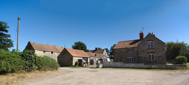
Image: © Bob Harvey Taken: 30 Jun 2018
The two story farmhouse is from around 1860, and the whole collection is one of the 19th century "model farms" that revolutionised the industry The single storey buildings to the left are a grade ii listed building (https://historicengland.org.uk/listing/the-list/list-entry/1360585 ) as are the range of farm buildings to the extreme left (https://historicengland.org.uk/listing/the-list/list-entry/1147802 ) The name Moat Farm comes from the scheduled ancient monument to the east of the buildings (https://historicengland.org.uk/listing/the-list/list-entry/1004964 ) which is thought to be medieval or even later (http://www.pastscape.org.uk/hob.aspx?hob_id=348667&sort=2&rational=m&recordsperpage=10&mapisa=1000&mapist=os&mapigrn=335500&mapigre=502500#aSt )
Images are licensed for reuse under creativecommons.org/licenses/by-sa/2.0
Image Location
Latitude
52.911209
Longitude
-0.470094