Panel showing the marching banner of the Toal-Harte Cumann of Killeavy Sinn F?in
Introduction
The photograph on this page of Panel showing the marching banner of the Toal-Harte Cumann of Killeavy Sinn F?in by Eric Jones as part of the Geograph project.
The Geograph project started in 2005 with the aim of publishing, organising and preserving representative images for every square kilometre of Great Britain, Ireland and the Isle of Man.

There are currently over 7.5m images from over 14,400 individuals and you can help contribute to the project by visiting https://www.geograph.org.uk
Panel showing the marching banner of the Toal-Harte Cumann of Killeavy Sinn F?in
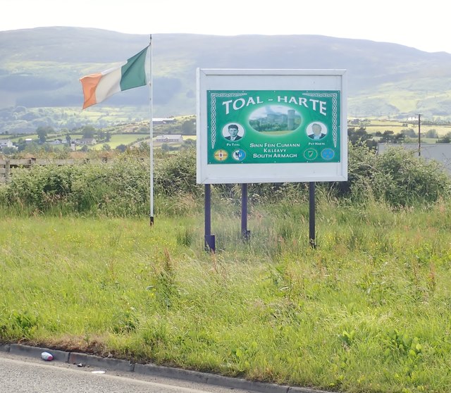
Image: © Eric Jones Taken: 21 Jun 2018
This cumann (branch) was set up in 2015 and is named after two local Republican activists. The panel stands alongside the B113 in the centre of the village. Slieve Gullion forms the background.
Images are licensed for reuse under creativecommons.org/licenses/by-sa/2.0
Image Location
Latitude
54.143681
Longitude
-6.357114