Vennel off Victoria Street
Introduction
The photograph on this page of Vennel off Victoria Street by Anne Burgess as part of the Geograph project.
The Geograph project started in 2005 with the aim of publishing, organising and preserving representative images for every square kilometre of Great Britain, Ireland and the Isle of Man.

There are currently over 7.5m images from over 14,400 individuals and you can help contribute to the project by visiting https://www.geograph.org.uk
Vennel off Victoria Street
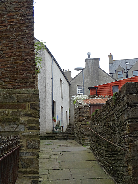
Image: © Anne Burgess Taken: 9 Jun 2018
Stromness has a well-defined mediaeval street layout, except that the vennels off the east side of the main street lead to the sea, not to fields as in most owns of that age. On the west side of the main street, however, the vennels would originally have led uphill to fields, but as was common in mediaeval towns, the land off the street was gradually built over with houses.
Images are licensed for reuse under creativecommons.org/licenses/by-sa/2.0
Image Location
Latitude
58.962462
Longitude
-3.2995