8 Rock Lane
Introduction
The photograph on this page of 8 Rock Lane by Ian Capper as part of the Geograph project.
The Geograph project started in 2005 with the aim of publishing, organising and preserving representative images for every square kilometre of Great Britain, Ireland and the Isle of Man.

There are currently over 7.5m images from over 14,400 individuals and you can help contribute to the project by visiting https://www.geograph.org.uk
8 Rock Lane
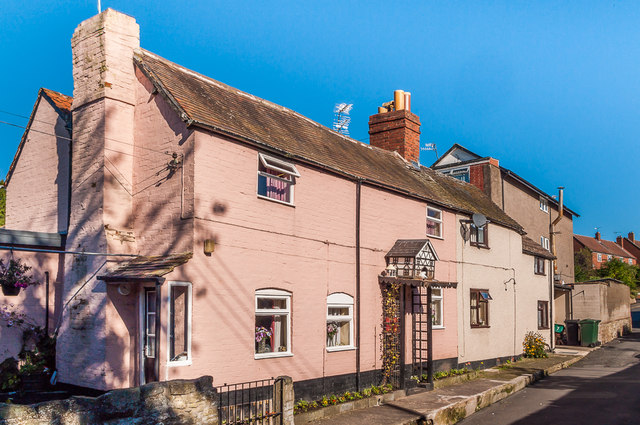
Image: © Ian Capper Taken: 4 Oct 2010
Historically Rock Lane was a track leading from Lower Galdeford to Rock Farm, but only the lower section has retained the original name, the middle part having been renamed Riddings Road and the upper part remaining as a public footpath. Some original cottages remain, this one being marked on the 1886 1:2500 map. For a close up of the dovecote over the door, see Image
Images are licensed for reuse under creativecommons.org/licenses/by-sa/2.0
Image Location
Latitude
52.370889
Longitude
-2.704416